
SNC continues work on floodplain mapping partnership
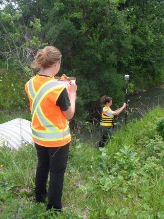
South Nation Conservation (SNC) staff is active this summer surveying private and public property as part of flood plain mapping in rural areas of the City of Ottawa.
In Phase 3 of the program, the following streams are currently being surveyed: Greys Creek from Manotick Station Road to Snake Island Road, Cassidy and McCooeye drains from Pana Road to the Castor River, and Devine and Marshall Seguin municipal drains.
The work is all part of a five-year partnership with the city and also includes Mississippi Valley and Rideau Valley Conservation Authorities.
“The objective is to identify and prepare for areas expected to be inundated during extreme high water events, permitting safe building practices away from those areas susceptible to flooding and erosion” said Sandra Mancini, SNC Team Lead Water Resources.
“Crews are in the field surveying culverts and bridges,” Mancini added, thanking private property owners for their “great response” and cooperation. Strong links with residents are essential to the success of the program.
In accordance with provincial policies, once determined through engineering analysis, floodplain limits are used to support appropriate land use planning and infrastructure design. Municipalities use floodplain mapping in preparing official plans and zoning bylaws. “The work this summer ensures that mapping is current and that recent land use changes are taken into account.”
After technical work is completed and floodplain mapping has been prepared, information sessions will be held to gauge public feedback. Relevant comments received will be taken into consideration for further refinement of floodplain limits before they’re finalized and adopted.
Education is a key element of the program, in that it creates a better understanding of how floodplain maps are created and what they mean. During the project, 1-100 floodplain limits will be determined using the latest hydrologic and topographic data, along with established practices in water resources engineering.
Floodplain limits are determined by estimating flow at various points along a watercourse using data collected over the years backed by state-of-the-art watershed modeling tools. Records of past flood events, news clippings, photos, and even anecdotal information can be helpful in confirming calculations and final mapping.
“Floodplain mapping is a preventative exercise,” Mancini noted. “It’s designed to foresee sensitive areas in maximum flood conditions and to ensure development proceeds safely in these areas.”
An open house for new Cassidy and McCooeye drain floodplain maps will be held towards the end of this year.
FOR MORE INFORMATION: Sandra Mancini, 1-877-984-2948 ext. 223, smancini@nation.on.ca