
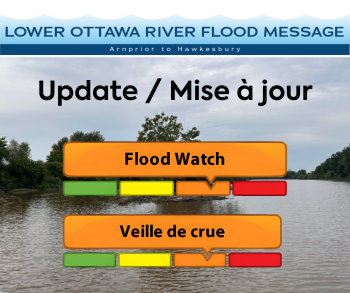
Update: FLOOD WATCH - Lower Ottawa River
This FLOOD WATCH is an update to the Flood Warning statement issued May 5, 2025, for areas along the Lower Ottawa River (Arnprior to Hawkesbury).
Water levels and flows along the Ottawa River have stabilized, with only small amounts of snow remaining in the northern part of the basin. Water levels are expected to remain elevated over the coming weeks, and the river will remain sensitive to widespread rainfall events.
Current forecasts indicate that water levels will stay well below 2023 peak levels, with minor flood levels exceeded from Pembroke to Hawkesbury, but peak levels expected below major flood thresholds.
Elevated water levels are forecasted to remain relatively stable, with gradual declines possible starting next week.
This advisory includes flood-prone areas at Lake Coulonge, Chats Lake, Britannia / Lac Deschênes,
Pointe-Gatineau, Cumberland, Rockland, and Hawkesbury.
Residents in flood-prone areas are encouraged to monitor conditions and continue necessary precautions:
- Ensure sump pumps are clear, in good working condition and have a backwater valve.
- Maintain easy access to a portable backup generator and pump.
- Keep downspouts clear and directed at least 3 m away from homes.
- Confirm driveway culverts are clear of debris and draining well.
- Secure loose items that could float away as flows increase.
The Mississippi Valley, Rideau Valley, and South Nation Conservation Authorities continue to monitor conditions alongside the Ministry of Natural Resources under Ontario’s Flood Forecasting and Warning Program. Updates will be provided as conditions change.
For current Ottawa River conditions and forecasts, visit: https://ottawariver.ca/conditions
For provincial flood warnings, visit: www.ontario.ca/law-and-safety/flood-forecasting-and-warning-program
This FLOOD WATCH is in effect until May 16, 2025, at 5:00 PM.
South Nation Conservation
Kat Watson, Coordinator, Early Warning Systems and Watershed Plans
kwatson@nation.on.ca | 1-877-984-2948
Definitions:
- Water Conditions Statement: Water Safety: indicates that high flows, melting ice or other factors could be dangerous for such users as boaters, anglers, and swimmers but flooding is not expected.
- Water Conditions Statement: Flood Outlook: gives early notice of the potential for flooding based on weather forecasts calling for heavy rain, snow melt, high winds, or other conditions.
- Flood Watch: potential for flooding exists within specific watercourses and municipalities. Municipalities, emergency services and individual landowners in flood-prone areas should prepare.
- Flood Warning: flooding is imminent or occurring within specific watercourses and municipalities.
— end —