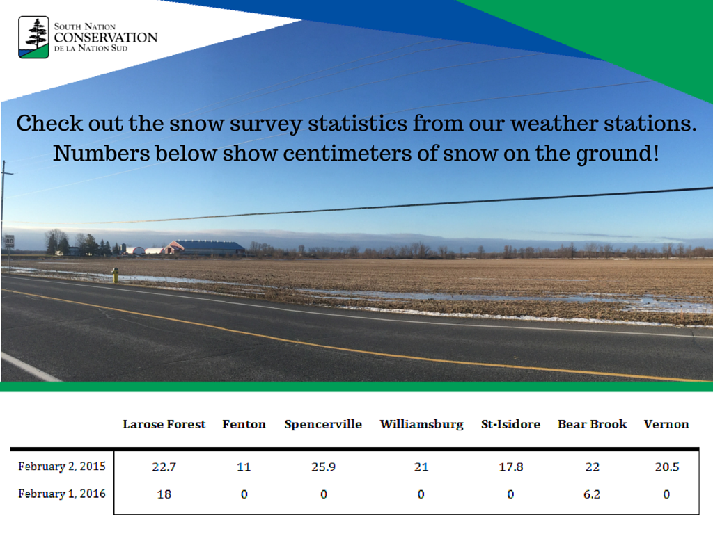
February Snow Survey Comparison
During the winter season, SNC samples snow conditions in the watershed twice a month. At each of the seven weather stations, the depth and weight of snow is carefully measured and recorded along with ground conditions. This information is used to calculate the amount of melt water or potential runoff contained in the snow. The data also helps estimate agricultural productivity, fertilizer requirements, waterfowl populations, and livestock and wildlife survival.
Snow sampling data is also submitted to the Ontario Surface Water Monitoring Centre, which collects the snow survey data from all Conservation Authorities in the province.
Winter ice conditions in the SNC watershed are also carefully monitored. The thickness of the sheet ice is checked when conditions permit.
This data collection is also useful as a comparative tool for annual conditions. The table below demonstrates the difference in the amount of snow present at the different monitoring stations in February of 2015 and 2016, values depict the number of centimetres of snow on the ground.