
WATERSHED CONDITIONS: Flood Outlook Statement
April 3, 2014, 9:00 a.m. SOUTH NATION WATERSHED – South Nation Conservation cautions that watercourses are expected to rise over the week due to above-freezing temperatures.
Environment Canada forecasts a gradual increase in temperatures for the next week with a high of 8 OC on Friday April 4th. Nights are still colder with temperatures below zero. Next week nightly temperatures start rising slowly.
Currently water levels are at normal for this time of year.
Snowpack is decreasing slowly in height however the water equivalent remains steady.
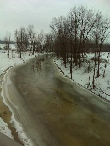
The forecasted weather will cause snow to melt and runoff to watercourses, which will increase river levels and flows throughout the South Nation watershed. Ice covering larger water courses may become unstable due to increased water levels.
There is potential for ice jamming when the runoff rates increase and if there is a large volume of ice remaining in the system.
If the weather continues to co-operate as currently forecasted, no flooding is anticipated.
Residents are advised to stay away from rivers as the forecasted weather may rapidly increase river flows, cause slippery river banks, and weaken ice cover. Parents are encouraged to explain these dangers to their children.
SNC staff will continue to monitor the water levels and weather forecasts as part of the Flood Forecasting and Warning program and will provide updates in the event conditions change.
SNC encourages the public to visit our webpage at www.nation.on.ca and to also provide feedback with respect to changes in water related conditions in their local areas (i.e. high water elevations, road inundation, ice break-up, etc.). All enquiries can be sent to Sandra Mancini or Golam Sharif at smancini@nation.on.ca or gsharif@nation.on.ca. For additional information please contact at SNC 1-877-984-2948 ext. 223 or 373.