
WATERSHED CONDITIONS – FLOOD WATCH - UPDATE
Time: 2:00 pm
The purpose of this bulletin is to provide information regarding the forecasted weather and the potential of flooding throughout the South Nation Conservation jurisdiction.
Rain gauges within the region have recorded between 15 and 40 mm since November 1st, 2017. Environment Canada is forecasting an additional 50 to 60 mm of rainfall this weekend, with showers ending on Monday morning.
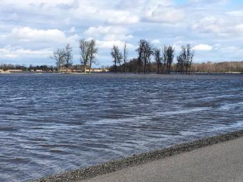
Water levels are expected to increase due to saturated soil conditions associated with the potential rainfall, which may cause flooding. In addition, some access roads may need to be closed due to flooding. There is also potential for blocked storm drains, catch basins and culverts which may also cause localized flooding.
Residents are advised to stay away from rivers as the forecasted weather may rapidly increase river flows, and cause slippery river banks. Parents are encouraged to explain these dangers to their children.
SNC will continue to monitor the water levels and weather forecasts as part of the Flood Forecasting and Warning Program and will provide updates as conditions change.
SNC encourages the public to visit www.nation.on.ca and to also provide feedback with respect to changes in water related conditions in their local areas. All feedback can be sent to waterwatch@nation.on.ca; posted on our Facebook (/SouthNationConservation), or Tweet us your photos (@SouthNationCA).
For more information, please contact at Omar Kana’n (613) 551-8952 or Sandra Mancini at (613) 551-3242.
This statement is in effect until Tuesday, November 7, 2017.
Forwarded To: All Flood Forecasting and Warning Directory
###