
WATERSHED CONDITIONS: Flood Outlook Statement
February 19, 2014 – South Nation Conservation cautions that watercourses are expected to rise over the week due to above-freezing temperatures and rainfall.
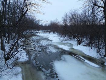
Environment Canada forecasts above-freezing temperatures of 1-7 OC from Wednesday to Saturday and approximately 15 mm rain for this week. The forecasted weather will cause snow to melt and runoff to watercourses, which will increase river levels and flows throughout the South Nation watershed. Ice covering larger water courses may become unstable due to increased water levels.
As temperatures are forecasted to return to freezing by early next week, severe flooding and ice jamming are not a concern at this time; however, nuisance flooding in low-lying areas may be observed. Furthermore, due to large ice and snow pack on the ground the potential for blocked storm drains, catch basins and culverts are very high which may also cause localized flooding.
Residents are advised to stay away from rivers as the forecasted weather may rapidly increase river flows, cause slippery river banks, and weaken ice cover. Parents are encouraged to explain these dangers to their children.
SNC staff will continue to monitor the water levels and weather forecasts as part of the Flood Forecasting and Warning program and will provide updates in the event conditions change.
SNC encourages the public to visit our webpage at www.nation.on.ca and to also provide feedback with respect to changes in water related conditions in their local areas (i.e. high water elevations, road inundation, ice break-up, etc.). All enquiries can be sent to Sandra Mancini or Golam Sharif at smancini@nation.on.ca or gsharif@nation.on.ca. For additional information please contact at SNC 1-877-984-2948 ext. 223 or 373.