
SNC Hosting Information Session for New Natural Hazard Mapping along the Bear Brook in the City of Ottawa
South Nation Conservation (SNC) invites residents to attend an online public information session to learn more about new floodplain and erosion hazard maps for areas along Bear Brook in the City of Ottawa.
The virtual session will take place on Thursday, March 31st from 7:00 PM to 8:00 PM and can be accessed by visiting www.nation.on.ca/consultations.
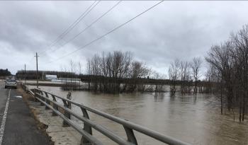
Natural hazard maps are used by municipalities and SNC when updating official plans and zoning schedules, and in reviewing development applications to protect people and property from natural hazards (such as flooding) and guide sustainable development activities.
Development projects within natural hazard areas (like floodplains) require permission from the Conservation Authority before proceeding. SNC updates natural hazard maps on behalf of its partner municipalities.
Following the information session, residents who wish to learn more can schedule in-person or online meetings with SNC staff on weekdays and evenings between April 4th and April 15th, 2022.
The South Nation, Rideau Valley, and Mississippi Valley Conservation Authority Partners work on behalf of the City of Ottawa to update floodplain maps in areas identified by the municipality with development pressures. More information on the priority areas can be found at: https://ottawa.ca/en/city-hall/public-engagement/projects/flood-plain-mapping
FOR MORE INFORMATION: Shannon Gutoskie, Communications Specialist, 1-877-984-2948, sgutoskie@nation.on.ca.
###