
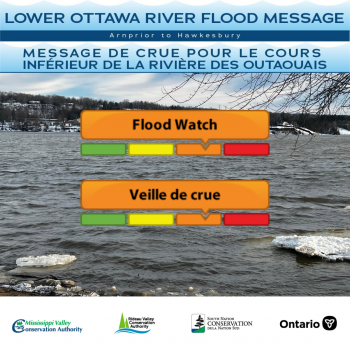
Water Conditions Statement: Flood Watch — Lower Ottawa River
This FLOOD WATCH statement is an update to the Flood Outlook Statement issued for areas along the Lower Ottawa River (Arnprior to Hawkesbury) on April 7th, 2023.
Due to significant snow melt and forecasted rainfall anticipated on Sunday and Monday, water levels are expected to continue rising within the Ottawa River Basin.
Most of the water currently entering the Ottawa River is located in areas where there are no reservoirs or retention capacity. The current strategy by the Ottawa River Regulating Committee is to reduce the amount of water released from the principal reservoirs to prevent water levels exceeding major flood levels.
The Ottawa River Regulating Committee anticipates that water levels along the main stem of the Ottawa River will exceed minor flood levels, impacting several streets and lawns in low-lying areas.
This includesflood-prone areas at Lake Coulonge, Chats Lake, Britannia / Lac Deschênes, Pointe-Gatineau, Cumberland, City of Clarence-Rockland, Thurso and other vulnerable areas down to Montreal. Areas at greatest risk are located in Cumberland and Rockland.
While there are currently no major flooding indicators of concern, it is still too early to forecast peak river conditions which remain dependent on snowmelt and rainfall amounts.
Residents in flood-prone areas are encouraged to closely follow changing conditions and to take necessary measures. Residents are advised to stay away from watercourses where flows are high and where banks might be unstable. Parents are encouraged to explain dangers to children and provide appropriate supervision around all waterbodies.
The Mississippi Valley, Rideau Valley, and South Nation Conservation Authorities monitor water levels and weather forecasts with the Ministry of Natural Resources and Forestry as part of the Flood Forecasting and Warning Program. Updates are provided as conditions change.
The Ottawa River Regulating Committee will be reassessing forecast conditions and providing hydrological condition updates on its website daily at www.ottawariver.ca/forecasts.
To view current flood warnings across Ontario, visit: www.ontario.ca/law-and-safety/flood-forecasting-and-warning-program.
This FLOOD WATCH STATEMENT is in effect until April 28, 2023 at 5:00 PM.
South Nation Conservation
MEDIA CONTACT:
Erin Thorne, Communications Specialist,
ethorne@nation.on.ca, 1-877-984-2948.
FLOOD DUTY OFFICER:
Jason Symington, Water Resources Specialist – Engineering
jsymington@nation.on.ca, 1-877-984-2948.
Definitions:
- Water Conditions Statement: Water Safety: indicates that high flows, melting ice or other factors could be dangerous for such users as boaters, anglers, and swimmers but flooding is
not expected.
- Water Conditions Statement: Flood Outlook: gives early notice of the potential for flooding based on weather forecasts calling for heavy rain, snow melt, high winds, or other conditions.
- Flood Watch: potential for flooding exists within specific watercourses and municipalities.
Municipalities, emergency services and individual landowners in flood-prone areas should prepare.
- Flood Warning: flooding is imminent or occurring within specific watercourses and municipalities.
— end —