
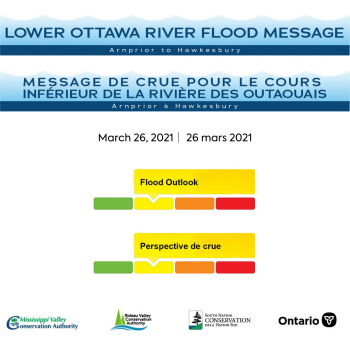
Water Conditions Statement: Flood Outlook — Lower Ottawa River
A Flood Outlook Statement is being issued for areas along the Lower Ottawa River. Based on current snow cover and weather forecast, it is anticipated that levels and flows along the main stem of the river from Arnprior to Hawkesbury are expected to begin to rise over the next few days but will remain within the normal range of fluctuations associated with the spring freshet period.
Presently, the snow cover varies significantly across the 146,300 square kilometre Ottawa River basin, with some areas in the south of the basin having no snow cover at all. Where there is snow cover, the snow water content (amount of water contained in the snow) is lower than average over much of the basin except in the west-central portion of the basin where average conditions prevail. Snow water content is only one of several factors impacting the magnitude of the spring freshet each year.
The Ottawa River Regulating Committee indicates that with the current weather forecast, flooding in low-lying areas is not expected to occur over the next few days. Levels are currently expected to remain below flood thresholds. While it is not possible to completely rule out the occurrence of a large spring freshet, the factors that are known at this time, namely below average snow water content in all locations and an early spring start, are positive indicators of a year without excessive flooding along the Ottawa River.
Throughout the freshet period, the combination of heavy rainfall and snowmelt may result in rapid increases in water levels and flows on the main stem of the Ottawa River from Mattawa down to the Montreal Region.
Residents in flood-prone areas are encouraged to closely follow evolving conditions and to take necessary measures. Residents are advised to stay away from watercourses where flows are high and where banks might be unstable. Parents are encouraged to explain dangers to children.
The Mississippi Valley, Rideau Valley, and South Nation Conservation Authorities monitor water levels and weather forecasts with the Ministry of Natural Resources and Forestry as part of the Flood Forecasting and Warning Program. Updates are provided as conditions change.
The Ottawa River Regulating Committee will be reassessing forecast conditions and providing hydrological condition updates on its website daily at ottawariver.ca/forecasts/.
To view current flood warnings across Ontario, visit: www.ontario.ca/law-and-safety/flood-forecasting-and-warning-program.
This FLOOD OUTLOOK STATEMENT is in effect until April 16, 2021 at 5:00 PM.
- end -
MEDIA CONTACT: Taylor Campbell, Communications Specialist, South Nation Conservation,
613-984-2948, tcampbell@nation.on.ca.
FOR MORE INFORMATION: Omar Kana’n, Water Resources Specialist – Engineering,
South Nation Conservation, 613-984-2948, okanan@nation.on.ca.
Definitions:
- Water Conditions Statement: Water Safety: indicates that high flows, melting ice or other factors could be dangerous for such users as boaters, anglers and swimmers but flooding is
not expected. - Water Conditions Statement: Flood Outlook: gives early notice of the potential for flooding based on weather forecasts calling for heavy rain, snow melt, high winds or other conditions.
- Flood Watch: potential for flooding exists within specific watercourses and municipalities.
- Flood Warning: flooding is imminent or occurring within specific watercourses and municipalities.