
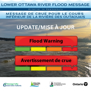
Update #4: Flood Warning — Lower Ottawa River
This FLOOD WARNING statement is an update to the Flood Warning issued for areas along the Lower Ottawa River (Arnprior to Hawkesbury) on May 2nd, 2023.
Water levels along the main stem of the Ottawa River reached peak levels on May 5th and 6th due to above normal snow melt in the upper region of the basin this spring, combined with large regional rain events that occurred over several days in late April and early May.
Based on Ottawa River Regulating Committee forecasts, it is expected that water levels will continue to slowly decline along the main stem of the Ottawa River. Water levels are expected to remain high for the next few weeks.
Affected locations includeflood-prone areas at Chats Lake, Constance Bay area, Britannia /Lac Deschênes, Cumberland, City of Clarence-Rockland, Township of Alfred Plantagenet, and other vulnerable areas down to Carillion Dam.
Peak river conditions remain dependent on the amount of rainfall received. Forecast levels over a four-day period are provided at the Ottawa River Regulation Planning Board website (Forecasts - Ottawa River Regulation Planning Board) and updated daily as conditions could change quickly. Wind and wave effects are not included in this forecast and water levels could fluctuate due to high wind gusts.
Residents in flood-prone areas are encouraged to closely follow changing conditions and to take necessary measures. Residents are advised to stay away from watercourses where flows are high and where banks might be unstable. Parents are encouraged to explain dangers to children and provide appropriate supervision around all waterbodies.
The Mississippi Valley, Rideau Valley, and South Nation Conservation Authorities monitor water levels and weather forecasts with the Ministry of Natural Resources and Forestry aspart of the Flood Forecasting and Warning Program. Updates are provided as conditions change.
The Ottawa River Regulating Committee will be reassessing forecast conditions and providing hydrological condition updates on its website daily at www.ottawariver.ca/forecasts.
To view current flood warnings across Ontario, visit: www.ontario.ca/law-and-safety/flood-forecasting-and-warning-program.
This FLOOD WARNING STATEMENT is in effect until May 23rd, 2023 at 5:00 PM.
Updates will be provided as conditions change.
South Nation Conservation
MEDIA CONTACT:
Erin Thorne, Communications Specialist,
ethorne@nation.on.ca, 1-877-984-2948.
FLOOD DUTY OFFICER:
Katherine Watson, Water Resources Specialist – Monitoring
kwatson@nation.on.ca, 1-877-984-2948.
Definitions:
- Water Conditions Statement: Water Safety: indicates that high flows, melting ice or other factors could be dangerous for such users as boaters, anglers, and swimmers but flooding is not expected.
- Water Conditions Statement: Flood Outlook: gives early notice of the potential for flooding based
on weather forecasts calling for heavy rain, snow melt, high winds, or other conditions.
- Flood Watch: potential for flooding exists within specific watercourses and municipalities.
Municipalities, emergency services and individual landowners in flood-prone areas should prepare.
- Flood Warning: flooding is imminent/occurring within specific watercourses and municipalities.