
 SNC prepares flood plain mapping for the major rivers and tributaries in the watershed, on a five-year cycle.
Protecting People and Property
We ensure that development does not occur in areas that are susceptible to flooding and erosion. Building in these areas can result in damage to properties when flooding or erosion occurs, and in extreme cases can result in loss of life.
In order to direct development away from flood and erosion-prone areas, we identify where these areas are located. One of the ways that we do this is by preparing floodplain mapping. We use this mapping when reviewing development applications.
Municipalities also use floodplain mapping in preparing official plans and zoning by-laws, which guide future development in their municipalities.
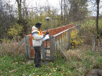
Preparing mapping involves a combination of field work and computer modelling. We gather background data such as land use, topography, and precipitation, and use this to build a computer model that calculates flows during storm events. The standard of protection is to the 1 in 100 year flood event. This is the event that has a one per cent chance of occurring in any year.
SNC, together with the Mississippi Valley and Rideau Valley conservation authorities, developed a five-year plan to update floodplain mapping within the City of Ottawa. We are updating the floodplain mapping in the City of Ottawa along watercourses with existing and future development pressure. The five-year plan includes technical work and floodplain mapping. The first year of the plan has our staff surveying three reaches of the Shields Creek Sub-watershed: Findlay Creek, John Boyce, and Osgoode Garden Cedar Acres.