
SNC to Host 2024 Virtual Natural Hazards Open Houses in February
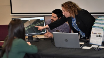
South Nation Conservation (SNC) invites residents living within three separate mapped areas of its jurisdiction to attend virtual Open Houses in February 2024 for an opportunity to learn more about new and updated floodplain and erosion natural hazard maps.
Residents and stakeholders with properties along the South Branch of the South Nation River within the United Counties of Stormont, Dundas and Glengarry (SDG) and the Township of Edwardsburgh Cardinal, or the Bear Brook and the Castor River within the City of Ottawa and United Counties of Prescott and Russell (UCPR) are welcome to join SNC staff to learn more about the natural hazards mapping project.
The recorded information sessions will take place in February 2024 and will give residents living near or within the regulation area, the opportunity to view the maps to better understand the risks to life and property in these shoreline areas.
Natural hazard maps are used by municipalities and SNC when updating official plans and zoning schedules, and in reviewing development applications to protect people and property from natural hazards (such as flooding) and guide sustainable development.
This study, supported by the Government of Canada, the Province of Ontario, the City of Ottawa, UCPR and SDG, and completed by SNC, used state-of-the-art digital topographic information, field surveys, bathymetry (water depth), and water resource modelling to better understand the flow of water and the location of flooding and erosion hazards during various storm events.
SNC maintains online mapping for the “Regulation Area” which is an area where study and permission from the Conservation Authority is required before building permits can be issued.These maps include the greater of either the 1:100 year floodplain (a storm event with a 1% chance of occurring in any given year) or where there are steep slopes or erosion hazard.
“We are happy to provide updated natural hazard mapping for these regions to help residents and stakeholders make informed decisions when modifying or developing property,” said Shahin Zand, SNC’s Water
Resource Specialist.
Following the information sessions in February, residents are also welcome to schedule in-person or virtual meetings with SNC on weekdays and evenings between March 1st and March 22nd, 2024 to learn more about their property and to view draft natural hazard maps.
More information about the virtual open houses and draft natural hazard maps can be accessed by visiting www.nation.on.ca/consultations.
For more information: Erin Thorne, SNC Communications Specialist, ethorne@nation.on.ca.