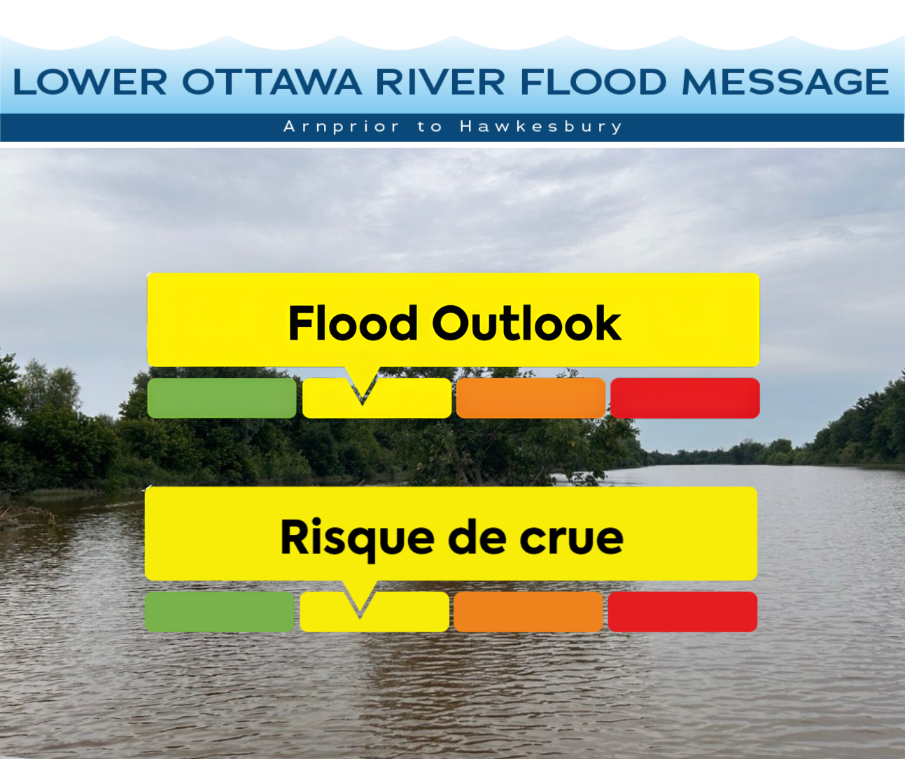
May 19th, 2026 – This Flood Outlook statement is an update to the Flood Watch issued for areas along the Lower Ottawa River (Arnprior to Hawkesbury) on May 4th, 2026.
Water levels and flows from Arnprior to Hawkesbury have stabilized and are expected to continue declining. Spring runoff remains elevated in the northern part of the basin; however, conditions have generally stabilized. As runoff from the northern basin continues to move downstream, water levels will remain elevated along the main stem of the river.
From Arnprior to Hawkesbury, minor flood levels are expected to persist in some flood-prone areas.
The minor flood level is defined as the level at which parts of some streets, lawns and parks are beginning to flood, with no or few houses/buildings being affected.
The major flood level is defined as the level at which one or several streets are beginning to flood, with several houses/buildings or neighbourhoods being affected.
Water levels have receded since April 22 and are expected to continue their decline. Minor flooding of low-lying roadways, parkland, and adjacent properties may persist for the remainder of the freshet for the Ottawa River basin.
Residents in flood-prone areas are encouraged to closely follow changing conditions and to take necessary measures, such as:
- Sump pump is clear, in good working condition and has a backwater valve on it.
- Easy access to portable backup generator and pump.
- Downspouts are clear and the outlet is at least 3 m from the dwelling.
- Driveway culverts are clear of debris and drain well.
- Securing items that might float away as flows increase.
Residents are advised to stay away from watercourses where flows are high and where banks might be unstable. Parents are encouraged to explain dangers to children and provide appropriate supervision around all waterbodies.
The Mississippi Valley, Rideau Valley, and South Nation Conservation Authorities monitor water levels and weather forecasts with the Ministry of Natural Resources as part of the Flood Forecasting and Warning Program. Updates are provided as conditions change.
The Ottawa River Regulating Committee will be reassessing forecast conditions and providing hydrological condition updates on its website daily at www.ottawariver.ca/forecasts/.
To view current flood warnings across Ontario, visit: www.ontario.ca/page/floods.
This FLOOD OUTLOOK is in effect until June 9, 2026 at 5:00 PM.
South Nation Conservation
Phillip Dagenais, Water Resources Specialist,
(613) 984-2948 | pdagenais@nation.on.ca
Definitions:
• Water Conditions Statement: Water Safety: indicates that high flows, melting ice or other factors could be dangerous for such users as boaters, anglers, and swimmers but flooding is not expected.
• Water Conditions Statement: Flood Outlook: gives early notice of the potential for flooding based on weather forecasts calling for heavy rain, snow melt, high winds, or other conditions.
• Flood Watch: potential for flooding exists within specific watercourses and municipalities.
• Flood Warning: flooding is imminent or occurring within specific watercourses and municipalities.
— end —
Next Article