September 22, 2026
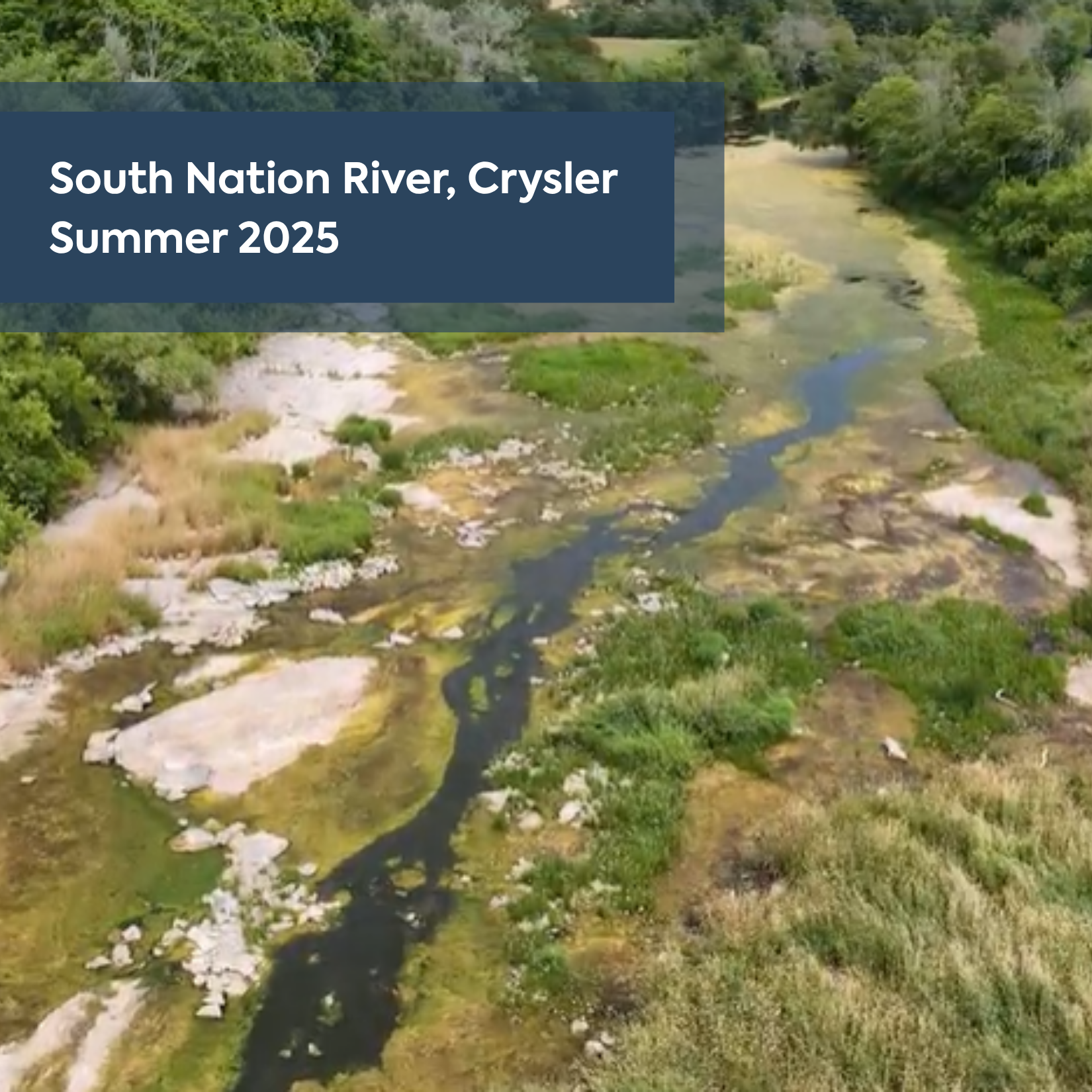
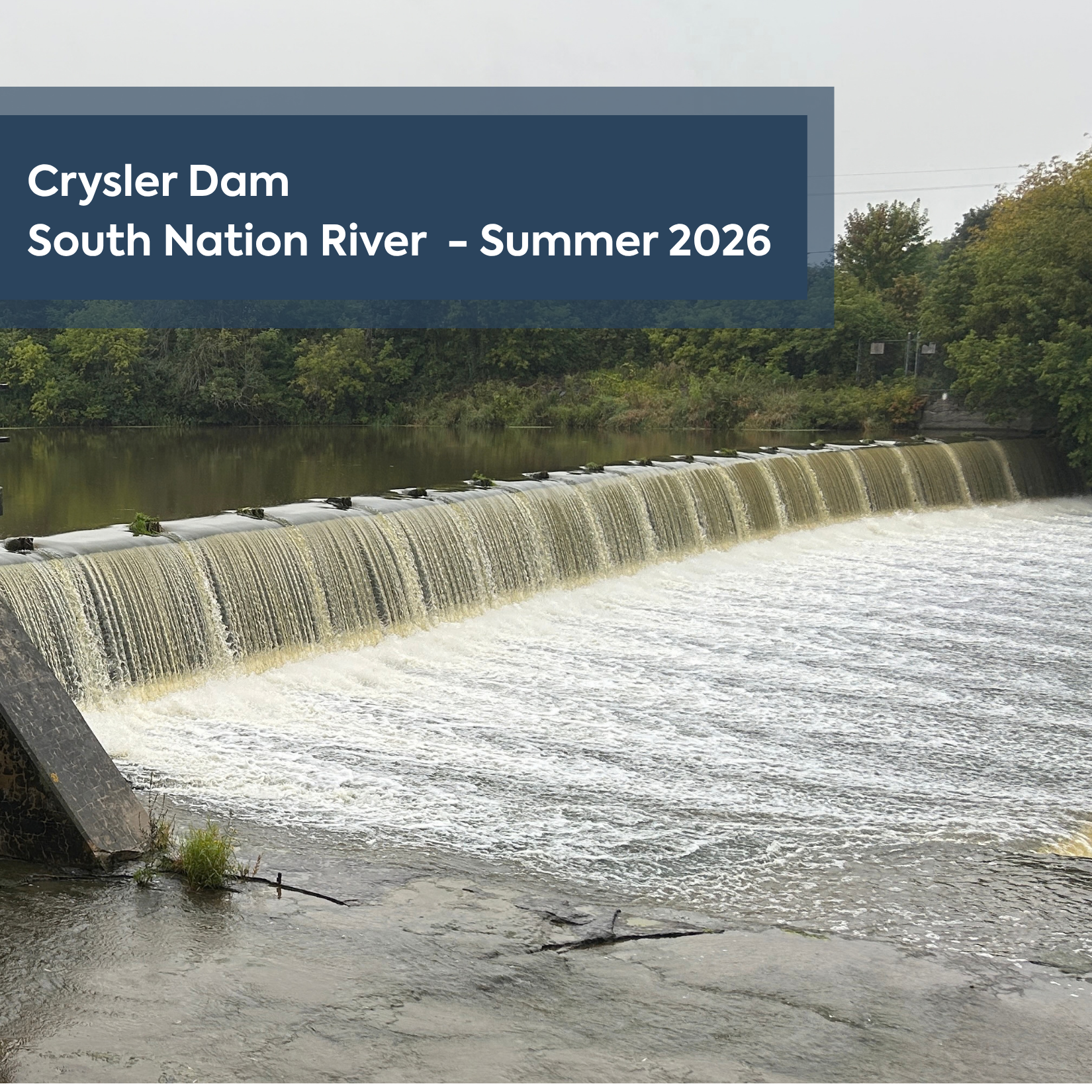
After one of the driest summers in recent memory in 2025, communities across the South Nation Watershed experienced a much wetter summer in 2026, with more frequent rainfall across the region.
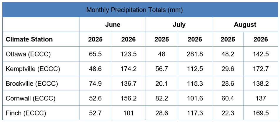
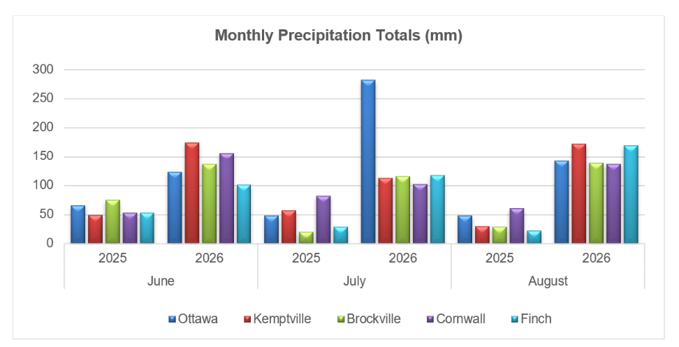
SNC climate stations recorded 10 rainfall events exceeding 10 mm, with a station in the City of Ottawa recording a total of 547.8 mm in June, July and August 2026. Several events have also produced unusually high rainfall totals, including 118.4 mm recorded on July 1 at the Ottawa International Airport, reaching a record daily total for that monitoring station (see Table 1 and Figure 1).
“Last summer, we were dealing with extremely dry conditions and talking to residents about conserving water, and water availability issues in private groundwater wells . This summer, we’re seeing a remarkable contrast,” said Katherine Watson, Coordinator – Early Warning Systems and Watershed Plans. “The differences we’re experiencing from one year to the next are a reminder of how quickly watershed conditions can change, and why monitoring our rivers, streams, rainfall, and groundwater is so important.”
Table 1: Monthly summer precipitation totals in 2025 and 2026
The change from 2025 to 2026 has been particularly noticeable. August 2025, SNC progressed through Level 1 and Level 2 Low Water conditions before declaring a Level 3 Severe Low Water Advisory across its jurisdiction. Some areas received only 17 mm of rainfall over a 30-day period, compared with a typical 80–90 mm. The prolonged dry conditions contributed to very low streamflow, dried-up tributaries, declining groundwater levels, and reports of dry or low-yielding private wells.
While rainfall is welcome following last year’s drought, heavy rainfall can also create challenges for communities, agriculture, waterways, and drainage systems. SNC continues to monitor conditions and provide information to municipalities and residents when changing conditions may affect water levels, flooding, erosion, or public safety.
“Rainfall is one piece of a much larger watershed picture,” said Watson. “Our staff look at rainfall, stream flows, water levels, soil conditions, and forecasts together to understand how the watershed is responding. This information helps us prepare for both wet and dry conditions and support communities across Eastern Ontario.”
The shift from drought in 2025 to wetter conditions in 2026 highlights the importance of preparing for greater variability in weather and water conditions. SNC’s monitoring network helps staff and municipal partners understand changing watershed conditions and plan for a resilient watershed.
Residents can stay informed about current watershed conditions, rainfall data, water levels, and flood and low water advisories through SNC’s website or SNC’s Facebook page.
SNC maintains a network of rainfall and stream gauges throughout the watershed and analyzes this information daily to support flood forecasting and warning, low water response, water control structure management, and other watershed programs.
To view daily updates from SNC’s monitoring stations, visit the Interactive Water Levels Map.
For more information: Kat Watson, Coordinator – Early Warning Systems and Watershed Plans, kwatson@nation.on.ca, 1-877-984-2948
Next Article